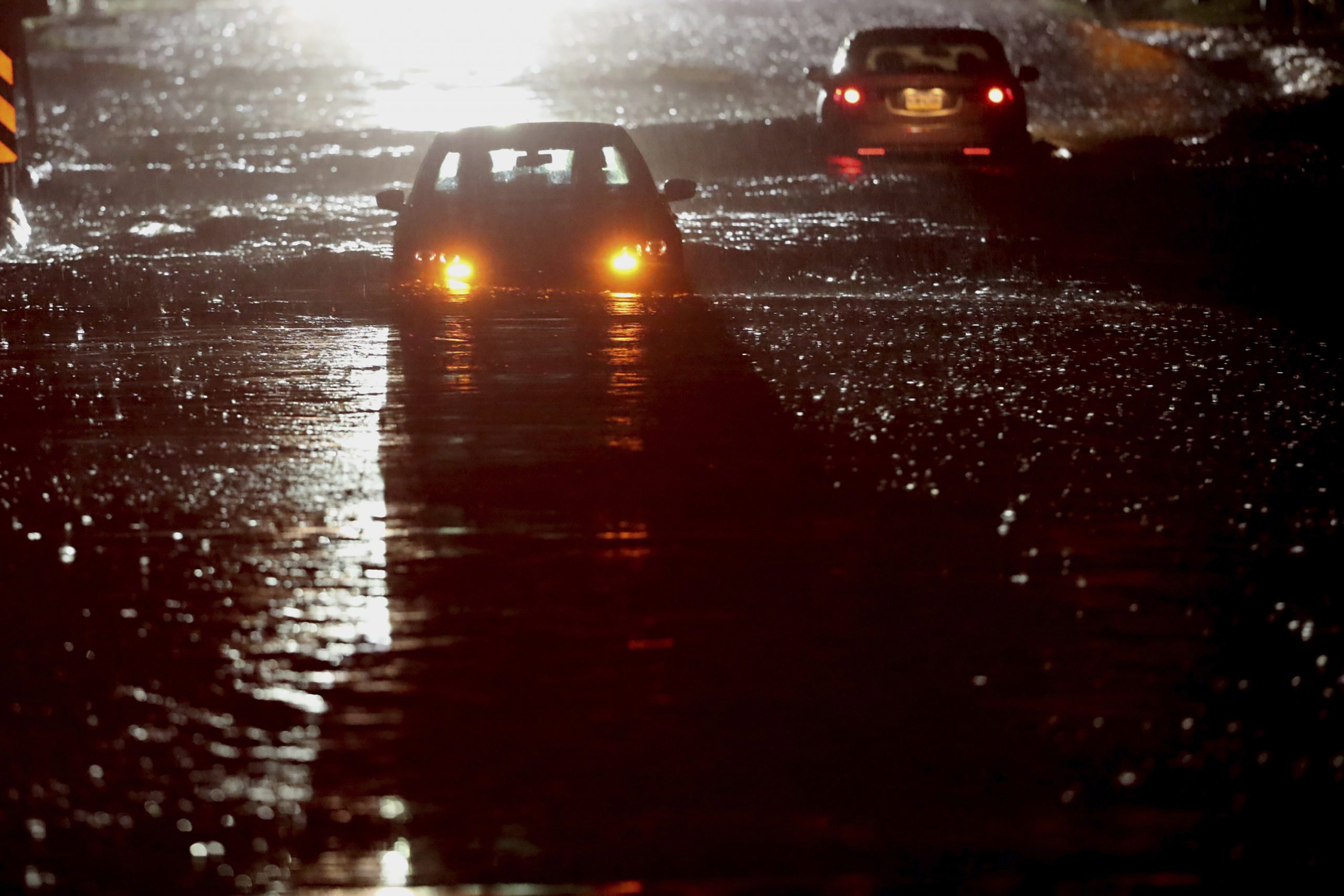
NEW YORK — Relentless rain from the remnants of Hurricane Ida sent the New York City area into a state of emergency early Thursday, as the storm carried into New England with threats of more tornadoes.
Posted Sep 02, 2021, 06:06AM EDT
NEW YORK — Relentless rain from the remnants of Hurricane Ida sent the New York City area into a state of emergency early Thursday, as the storm carried into New England with threats of more tornadoes.
New York’s FDR Drive, a major artery on the east side of Manhattan, and the Bronx River Parkway were under water by late Wednesday evening. Subway stations and tracks became so flooded that the Metropolitan Transportation Authority suspended all service. Videos posted online showed subway riders standing on seats in cars filled with water.
Other videos showed vehicles submerged up to their windows on major roadways in and around the city and garbage bobbing down the streets.
“We’re enduring an historic weather event tonight with record breaking rain across the city, brutal flooding and dangerous conditions on our roads,” New York Mayor Bill de Blasio said while declaring a state of emergency in New York City late Wednesday.
Gov. Kathy Hochul also declared a state of emergency for New York state.
The National Weather Service office in New York declared its first-ever set of flash flood emergencies in the region Wednesday night, an alert level that is reserved for “exceedingly rare situations when a severe threat to human life and catastrophic damage from a flash flood is happening or will happen soon.”
New York City put in place a travel ban until 5 a.m. ET Thursday for all non-emergency vehicles.
The National Weather Service recorded 3.15 inches of rain in New York’s Central Park in one hour Wednesday night, far surpassing the 1.94 inches that fell in one hour during Tropical Storm Henri on the night of Aug. 21, which was believed at the time to be the most ever recorded in the park.
Earlier Wednesday, the storm blew through the mid-Atlantic states with at least two tornadoes, heavy winds and drenching rains that collapsed the roof of a U.S. Postal Service building in New Jersey and threatened to overrun a dam in Pennsylvania.
Social media posts showed homes reduced to rubble in a southern New Jersey county just outside Philadelphia, not far from where the National Weather Service confirmed a tornado Wednesday evening. Authorities did not have any immediate information on injuries.
The roof collapsed at the Postal Service building in Kearny, New Jersey, with people inside, police Sgt. Chris Levchak said. Rescue crews were on scene into the night, with no immediate word on the number of people or severity of injuries.
Gov. Phil Murphy declared a state of emergency in all of New Jersey’s 21 counties, urging people to stay off the flooded roads. Meteorologists warned that rivers likely won’t crest for a few more days, raising the possibility of more widespread flooding.
At least one death was reported in the state. Passaic Mayor Hector Lora told news outlets that someone died in the city after being submerged in their car.
Soaking rains prompted the evacuations of thousands of people after water reached dangerous levels at a dam near Johnstown, a Pennsylvania town nicknamed Flood City. An official said later Wednesday that the water levels near the dam were receding.
Utilities reported hundreds of thousands of customers without power in New Jersey and Pennsylvania.
In Rockville, Maryland, water had almost reached the ceilings of basement units Wednesday when crews arrived at an apartment complex. A 19-year-old was found dead, another person was missing and about 200 people from 60 apartments near Rock Creek were displaced, Montgomery County Fire Chief Scott Goldstein said Wednesday.
A tornado was believed to have touched down along the Chesapeake Bay in Maryland.
“In many years I have not seen circumstances like this,” Goldstein said.
The National Weather Service had predicted flooding from what remained of Hurricane Ida, saying steep terrain and even city streets were particularly vulnerable to a band of severe weather that extended to Massachusetts, where tornado warnings were issued early Thursday.
Tropical Storm Henri hit the region a little more than a week ago, causing flooding and leaving the region saturated and more vulnerable to this week’s torrents.
Tropical Storm Larry was strengthening and moving quickly westward after forming off the coast of Africa earlier Wednesday. Forecasters predicted it would rapidly intensify in a manner similar to Ida, becoming a major hurricane with top wind speeds of 120 mph (193 kph) by Saturday.


